
If you live in the Plains states:
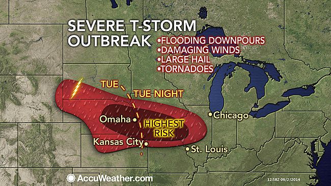
A major outbreak of severe weather will ignite across the central Plains Tuesday afternoon with a possible derecho evolving during the overnight hours.
The potential exists for a far-reaching cluster of violent thunderstorms to track from Nebraska to Iowa and northern Illinois Tuesday night through Wednesday morning.
Such an intense cluster may officially be deemed a derecho.
“The origin of this potential strong line of storms will be in western Nebraska where afternoon thunderstorms will congeal into an intense cluster overnight Tuesday and progress through Iowa and into northern Illinois through Wednesday morning,” stated AccuWeather Enterprise Solutions Meteorologist Brian Knopick.
“The threats would be extremely heavy rain with flooding, large hail and wind gusts greater than 70 mph.”
SOP for ‘tornado alley.’ Too bad rethugs think early warning is a waste of time.